Roads and Road Accessories
Click on screenshot to download from the DLS
Road
| Screenshot | Description | Source file(s) |
|
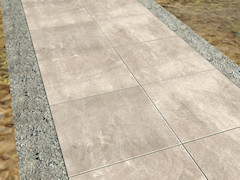
Concrete highway (1920's)Two lane concrete highway. Built to a 1920 Nevada State Highway Department specification, specifically for the highway between Reno and Carson City. 21 feet wide with a Portland cement concrete pavement 15 feet wide. Updated April 12, 2012 with better textures |
Signs
| Screenshot | Description | Source file(s) |
|
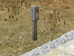
Lincoln Highway markerConcrete marker for the Lincoln Highway. Version: TS 2009 and later |
|
|
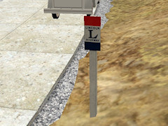
Lincoln Highway signSign for the Lincoln Highway. Also available without a post (for placing on telephone poles, etc.) Version: TS 2009 and later |
|
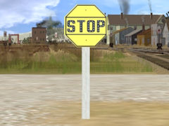 |
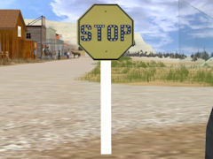
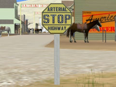
Stop sign 1Yellow stop sign. Standard design from 1924 until sometime in the 1930s or 1940s. |
|
 |
Stop sign 2Yellow stop sign. Standard design from 1924 until sometime in the 1930s or 1940s. |
|
 |
Stop sign 3Yellow stop sign. Standard design from 1924 until sometime in the 1930s or 1940s. |
|
 |
Stop sign 4Yellow stop sign. Standard design from 1924 until sometime in the 1930s or 1940s. |
|
 |
Stop sign 5Yellow stop sign. Standard design from 1924 until sometime in the 1930s or 1940s. |
|
 |
Stop sign 6Yellow stop sign. Standard design from 1924 until sometime in the 1930s or 1940s. |
|
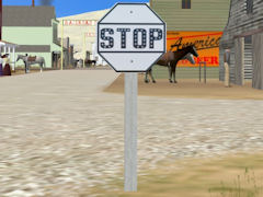 |
Stop sign 7White stop sign. My guess at what the standard design looked like from 1922 until 1924, when yellow was decided as a better background color. |
|
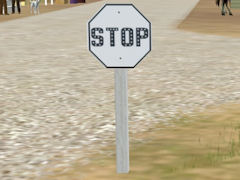 |
Stop sign 8White stop sign. Another guess at what the standard design looked like from 1922 until 1924, when yellow was decided as a better background color. |
|
|
V & T RR Crossing Sign (old)Based on a 1930's photograph east of Carson City, NV. Version: TS 2009 and later |
|
 |
Southern Pacific Crossing SignBased on a 1922 photograph in downtown Reno, NV. Version: TRS 2004 and later |
|
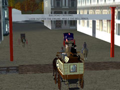 |
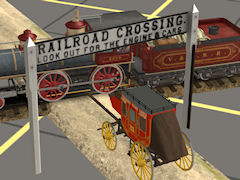
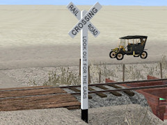
Old East Railroad Crossing signBased on a photograph of a sign in Hingham, Massachusetts ca. 1861. Coloring is hypothetical. Text on the sign was dictated by state law as early as the 1830's, and reads "Railroad Crossing. Look out for the engine while the bell rings." Version: TRS2004 and later |
|
 |
Old West Railroad Crossing signBased on a photograph of a sign in Rathdrum, Idaho in 1888. Coloring is hypothetical. Version: TRS2004 and later |
Bridges
| Screenshot | Description | Source file(s) |
|
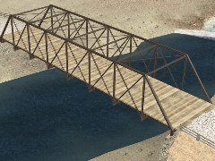
40' wide Truss road bridgeBased on 2nd Street bridge in Reno, NV; ca 1918 3 levels of detail; 1066 / 537 / 307 polygons Version: TS2009 and later |
GMAX source files (433KB) |

|
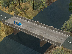
30' wide Truss road bridgeTwo lane bridge with attached invisible road; by request 3 levels of detail; 1190 / 806 / 488 polygons Version: TS2009 and later |
|

|
15' wide Truss road bridgeSingle lane bridge with no attached road; by request. A spline version is also available. 3 levels of detail; 1189 / 780 / 489 polygons Version: TS2009 and later |
|
|
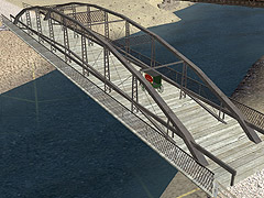
Bow truss road bridgeBased on old Virginia St bridge in Reno, NV. Bridge was built in 1877; moved in 1906 to what is now known as Museum Dr (next to the Auto Museum) when the current Virginia Street bridge was built. Destroyed in a flood, 1950. 3 levels of detail; 944 / 582 / 292 polygons Version: TRS2004 and later |
GMAX source files (600KB) |
 |
Concrete road bridgeTypical of bridges built in the US in the 1920's. A matching pier is also available. Version: TRS2004 and later |
GMAX and .psd source files; 16MB |